
Route du Rhum forecast still shows 35-40 knot winds
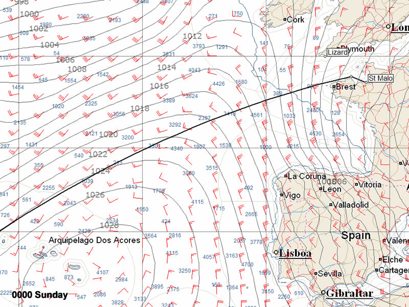
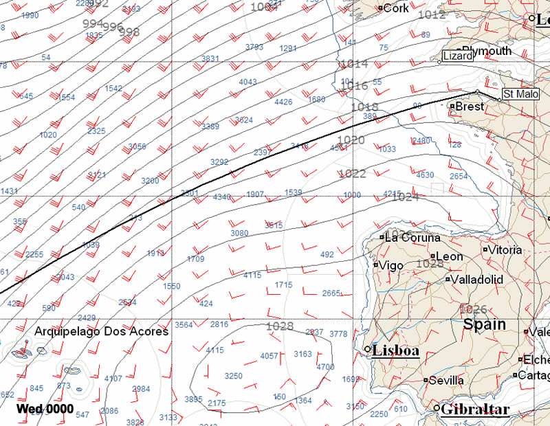
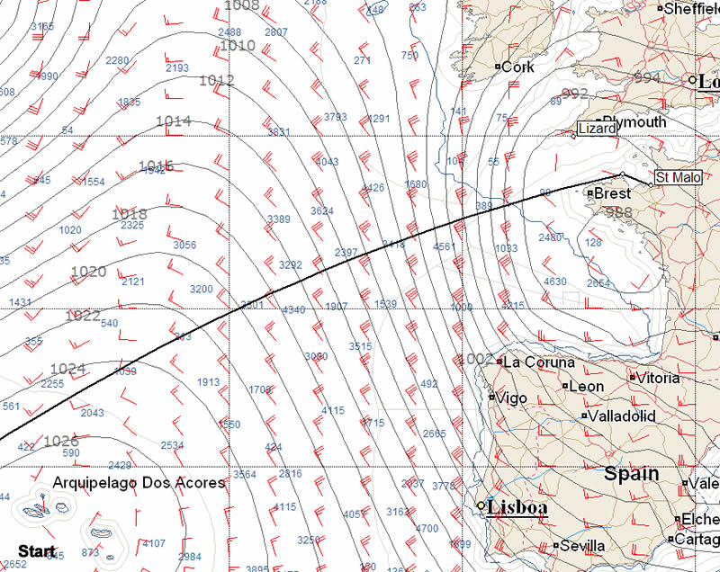
Since we last looked at the forecast for the first days of the Route du Rhum, so the 40 knots conditions the front runners looked set to encounter overnight on Sunday have decreased slightly.
As before the weather at the start looks relatively benign. Both European and American models indicate that come start time tomorrow (Sunday) a depression will be centred over Brittany and this is likely to mean light southeasterlies for the start. This depression moves over mainland France over the course of the rest of the day leaving behind it a band of strong NNWerly winds that were previously indicating 40+ knot conditions overnight, but which are now down to merely 35 knots for the front runners according to the European model while the American GFS GRIB continue to indicate 40 knots once the leaders are around Ushant. However it should be remembered that coming on the back of a depression these winds will follow the strong southwesterlies that are blowing in the Bay of Biscay today and this will lead to a confused sea state particularly as the leaders cross the continental shelf.
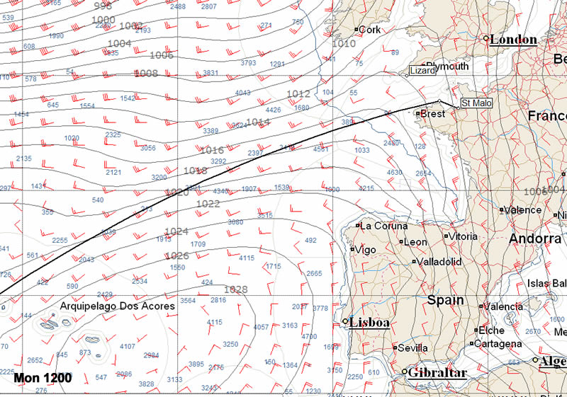
Conditions now look set to abate during Monday morning with the wind backing into the west.
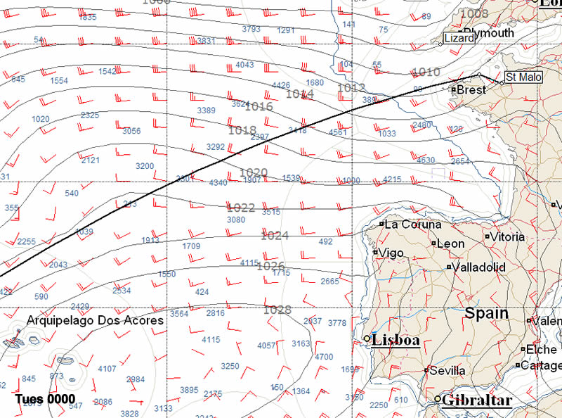
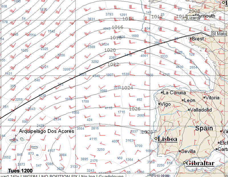
While the first night looks hard for the front runners, it is okay for those astern although the residual sea state won't be pleasant on Monday. But the big issue which the skippers and their teams are already looking at prior to their departure is the long term forecast. Unfortunately the North Atlantic once again looks to be in disarray for the Route du Rhum as by Tuesday the Azores high is forecast to be shoved east towards Portugal. While the Ultimate class boats could sneak through at present the routing is sending pretty much all the boats north towards the Azores. So it seems unlikely that this will be a pleasant Trade Winds Route du Rhum. Instead it is likely to be more of a headbanging Solidaire du Chocolat.
Sylvain Mondon of Météo France is working with Marc Guillemot's Safran team and gives his take on the IMOCA 60 forecast: For the start...“we shall be in the middle of a low-pressure area: the advantage is that we should be sailing downwind, but what complicates matters is that it will probably mean a lot of transitions to deal with, which will entail a lot of manoeuvres, such as changing the spinnaker to the gennaker and back.
“At the start we can expect 15-knot south-easterly winds, which will ease off as the low moves in during the afternoon. Then the wind will veer north-westerly on Sunday evening and freshen to 20-25 knots. For the IMOCA boats, that will correspond to the second part of the exit from the English Channel, and the seas are likely to be moderate to rough with 2-3 metre high waves.”
“Before Ushant in order to embark on a more or less westerly route, or alternatively head more or less south. What is going to count is the position they are in relative to the Azores high.”
As for the rumour doing the rounds on the pontoons concerning the likelihood of a tropical depression lying in their path ten days from now, Sylvain Mondon believes that “ it is one of the possible situations that may arise. We can’t be certain of what will happen looking ten days ahead, but it’s something we shall be watching out for at the end of the cyclone season.”
The images below are based on the European model.
Images courtesy of Expedition navigation software and PredictWind.

Businesses

Pro businesses
Editor's choice
Member blogs
-
 Ned Collier Wakefield: MOD70 round BarbadosWell that was intense. 12 hard fought for seconds for the win. In idyllic conditions, Tony Lawsons MOD ...
 -
 Mini Transat leg 2 reportThe second leg of the Mini Transat started on 31st October, just over a month after ...
 -
Leg 1 reportI’ve been working towards the Mini Transat now for three years. In 2013 I was part ...
Business blogs
-
 The Island Sailing Club in Cowes, Isle of Wight, is delighted that Prince Michael of Kent ...
 -
Peta Stuart-Hunt chats with the 25 year-old British solo sailor Lizzy Foreman before she sets sail ...
-
The 2015 Student Yachting World Cup (SYWoC), an ISAF-recognised event hosted and run by students for ...
Editor's Choice
-
 Three legs down into Ian Walker’s
 -
 Winning all but two races at
 -
 For the first time in its
Latest Comments
Add a comment - Members log in