Number cruncher
Thursday October 16th 2008, Author: James Boyd, Location: United Kingdom
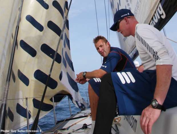
Down below on
Ericsson 4 is very much ‘chez Salter’ with younger brother
Guy occupying one desk as he handles the media slot, while elder brother Jules is at the other as he manages the on board navigation.
Following on from his time at GBR Challenge, Jules Salter cut his teeth on the round the world race course when he was appointed navigator on Paul Cayard’s Pirates of the Caribbean in the 2005-6 Volvo Ocean Race, ultimately finishing second, despite all manner of technical problems besetting the boat during the early stages of the race. This time as navigator for Ericsson 4, the A boat of the team that has had the most preparation time and resource for this year’s Volvo Ocean Race, effectively puts Salter at the top of the tree among ocean racing navigators.
Typically the hardware around a Volvo Open 70 chart table has not developed much over recent years. The boats are all using B&G performance instrument packages with a variety of displays dotted around the cockpit, on the cockpit bulkhead and on the mast. B&G introduced their WTP2 (Wave Technology Processor) processor that drives the instrument package around the time of the start of the last Volvo Ocean Race. The WTP2 uses a faster process and does a better job at correcting out the boat’s motion to provide more accurate wind information. Otherwise chart tables are fitted with a display head for the radar, the handsets for the radios (the handsets for the Fleet Broadband and Fleet 33 satcoms handsets are usually at the media station) and a man overboard detector and little else. Gone are the clunky weatherfax machine and SSB radios (although an SSB must be carried as a back-up).
However the central feature is certainly the computer or computers. For redundancy’s sake, all boats run twin computers although only one may be used at any time. These are primarily used for running powerful routing software. The software of choice these days seems to be Deckman as well as the Expedition software written by former Newscorp navigator Nick White. MaxSea seems to be less popular than it once was. While this is not new software by name it has developed considerably through new version releases.
On board Ericsson 4, Salter’s computer is loaded with all three programs although he typically uses Deckman and Expedition. So why does he need both? “They deal with things in different ways," he explains. "Some people are more comfortable with using one system and you do see some slight differences between the two and also if your competitors are running that and there is a difference, you might want to see what they are thinking as well - so it is covering all bases really and it doesn’t weigh anything.”
According to Salter he doesn’t use this software to run routing for the other boats as a matter of course, but might do when they split up (as they have been passing through the Canaries). “Obviously you are implying they are going the same speed as you and you apply a similar polar performance, which I guess you can do. We did that in the last race and it worked reasonably well: we just added 2 knots for ABN AMRO all the time, but amongst the Farr boats it was a pretty good gauge! Obviously our sistership [ Ericsson 3], we know how well she goes and we know how the old ABN AMRO boat [now Delta Lloyd] goes because we used that as a training boat. But the bottom line is that you are still applying a weather file which is theoretical and not real and that can make a big difference. We’ve seen how one knot of wind can make a big difference in the performance of these boats and how well they are being sailed. They are the biggest drivers of performance.”
An improvement since the last race is in the amount of weather data they are sent through from race control. In the 2001-2 race prior to each leg navigators were able to nominate 10 websites they could view during the leg, but this was found to be both time consuming and very costly, so for the subsequent race the organisers returned to the system of supplying all the boats with the same weather information - GRIB files, satellite images, synoptic charts and forecasts. This time it is the same only that there is more of it - GRIB files for example are supplied over a slightly longer period (although Salter says that after five days they are pretty worthless) and depending on the corner of the globe they are in higher resolution. GRIBs, electronic files that show wind direction and speed plotted over a grid (as appear in our Volvo updates) are derived from weather models, usually run on supercomputers by the larger met offices around the world (although it is possible these days to run smaller versions on laptops!). While in the previous race the teams were supplied with GRIBs based on the American GFS and British UKMA models, this time they are also getting the European EEC model.
“So you have run all those routes and work out the differences between models and timings and then you work out which model is applicable at that time - so there is plenty to do,” says Salter.
Of course all the models will be different and will differ to varying degrees from day to day and the job of the navigator is to make the best call on which, if any, of the models is the one they can most trust given the area of the world they are in, the accuracy of the model over the previous days and the actual weather they can see outside up on deck in the real world.
So how does Salter decide which to use? “There are hints to it. Anywhere where America has an interest militarily or financially then their model is pretty good, but that is most of the world! You might find that a model is not particularly in a certain area but it might just nail it the few days you are there. Initially I like to look at a few hand drawn charts or at least charts which are done by a proper met office with proper meteorologists and you can get a good idea from that straight away the overall general features and even some detail you can infer from that. Then you can easily jump to a GRIB and run a route and say ‘okay, I’ve done my work - off we go, that’s it’. But the GRIBs never line up 95% of the time to exactly what you’ve got. If you draw the averages out it might fit a bit better. It is such a variable thing –- it is not an exact science by any means.”
Experience also plays a large part and one imagines that Telefonica Black’s venerable navgiator Roger Nilson or Andrew Cape who earlier this year completed a round the world lap two handed with Alex Thomson in the Barcelona World Race (and before that was on this race with movistar/Ericsson, Toshiba and Tokio), must hold some extra cards over their rookie competition.
Aside from the tactics of how to use the weather in conjunction with the sweet spots in the boat’s polars to get down the race track the fastest, in this ever more competitive Volvo Ocean Race there is also the stategic issue of racing other boats. Salter explains the process: “You would say – what is the optimum route to get from A to B and then where is the fleet and what is the risk of edging a bit closer to the fleet or if we are 100% confident we might just strike out and go our own way. All these navigators are very good and they are all using the same software and the same weather, so the results shouldn’t be radically different. You might see people just hedging a bit more leverage one way or the other. Some people might go for broke, but it is a long race so I think people will start off reasonably conservatively and get to know their boats and performance relative to the other boats, and then we might see some bigger things later on in the race.”
In addition to the weather information supplied by Volvo, navigators can also pull in publicly available data, just not via the internet. For this reason most have satellite receivers that are able to download images direct from satellites. This is nothing new (Vincent Geake once showed us this on board Lawrie Smith’s Rothmans maxi) and the give-away as to which boats use this is the helical antenna at the back of the boat.
“It can be useful in the Doldrums, but there is a bit of luck involved in whether you are below a satellite at the time you are passing through and these boats are quite dynamic in moving around, so the antenna has to get a clear view of the sky and if you happen to be on the wrong tack or 10deg heading difference either way you won’t get the full satellite picture. So there is a bit of luck involved.”
Typically on board the major long term decisions on board Ericsson 4 as to where to go and how to get there will be made by skipper Torben Grael and Salter, however shorter term it is made also in conjunction with the leaders of the two watches Stu Bannatyne and Brad Jackson.
While the gear is very similar between the boats the set-up of the chart tables is very different between boats. Typically the nav station whether it is on a VO70 or the 60s that preceeded them is squeezed beneath the cockpit sole with the navigator having their own seat facing forward. However for the last race on ABN AMRO One navigator Stan Honey had a set-up that allowed him to sit to weather with the instrument panel able to be rotated around a central pole. As the pictures on the following page show on Puma and Green Dragon they appear to have gone down the same route as ABN AMRO while on Ericsson 3 and Team Russia they still have the conventional set-up.
Next week we will publish the low down from Salter and Team Russia navigator Wouter Verbraak about what we can expect on the new legs of the course to India, Singapore and China.

Most Read
Most Commented
Comments
Businesses

Pro businesses
-
United Kingdom
-
France
-
-
France
Editor's choice
Member blogs
-
 Ned Collier Wakefield: MOD70 round BarbadosWell that was intense. 12 hard fought for seconds for the win. In idyllic conditions, Tony Lawsons MOD ...
 -
 Mini Transat leg 2 reportThe second leg of the Mini Transat started on 31st October, just over a month after ...
 -
Leg 1 reportI’ve been working towards the Mini Transat now for three years. In 2013 I was part ...
Business blogs
-
 The Island Sailing Club in Cowes, Isle of Wight, is delighted that Prince Michael of Kent ...
 -
Peta Stuart-Hunt chats with the 25 year-old British solo sailor Lizzy Foreman before she sets sail ...
-
The 2015 Student Yachting World Cup (SYWoC), an ISAF-recognised event hosted and run by students for ...
Editor's Choice
All time favourites...
-
 Three legs down into Ian Walker’s
 -
 Winning all but two races at
 -
 For the first time in its
Latest Comments
Add a comment - Members log in